

What do you need?
Destination
Category


Sports & Adventure
Pliego Castle and Cairel Route. PR-MU77
30176 -Pliego-
Spanish name: El Castillo de Pliego y el Cairel
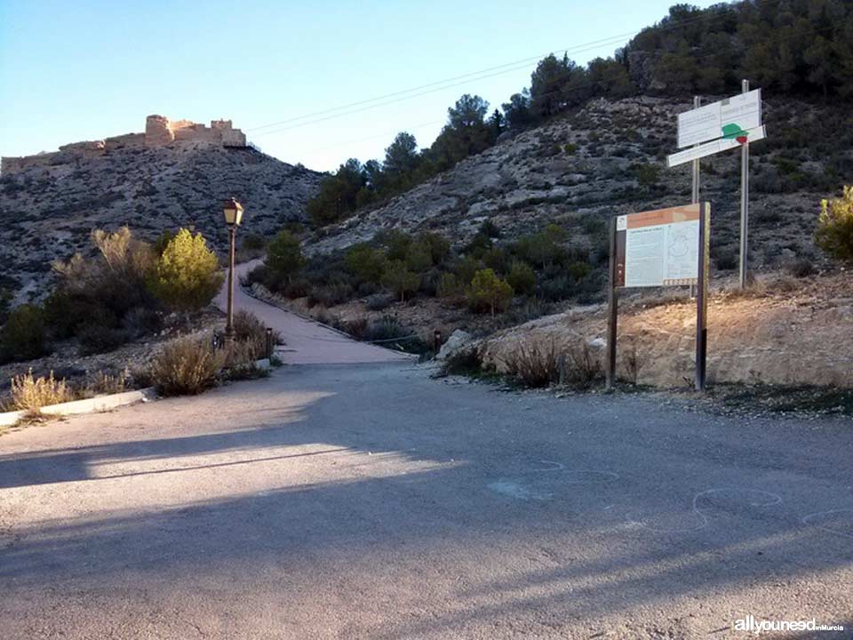 Beautiful mountain route on perfectly marked trails combining history – Pliego Castle - and magnificent views of Sierra Espuña, Pliego and Mula. Breathe fresh air! The route starts in the parking lot under the castle. You can also begin the walk in the parking area near the “Virgen de los Remedios” chapel.
A steep slab-covered road leads to the castle, first place in this route. Once by the castle, you will see a trail sign. About 300 meters after you start the walk, there is a trail off to the left that goes to the road connecting to “senda de la Muela”. Don't take it. Some 1100 meters after the trail starts, there is a dirt path. The trail goes across a road, although we advise you to take the road on your right to visit an area of antennas and a viewpoint, where there are magnificent views of Sierra Espuña, Pliego and Mula, among other places. After this, go back to the trail and continue on the route. Although there are other trails, we recommend you continue until a detour, some 2.5 kilometers later. Then go across the C-3315 road and along the cemetery until the entrance to Pliego. After the cemetery, take a right until you get to the campsite (closed when we were there) and continue to the Cinto avenue and back to the parking lot.
The Wikiloc route includes clear indications, with pictures and points of interest.
Get directions:
Take the RM-15 freeway to Caravaca de la Cruz; take the Mula-Pliego exit. Go around Mula and in the second roundabout, take the road to Pliego (C-3315). Once in Pliego, it is best to continue on the road that runs through it (Avda. de Alhama). Then, get on the Cinto avenue until you see the “castillo” sign on your right. If you go straight, you will get to a crossroad. Take a right to get to the parking lot of “Virgen de los Remedios” chapel, where you can park. This point marks the start of the Muela route and of a trail to Paleras castle ruins. Once the route is completed and you wish to visit Pliego, walk from the chapel along the street Nueva and street Caños to visit the historical center of Pliego.
Characteristics of the route:
Start and End: Esplanade of the castle parking lot Route: Circular
Distance: 5.28 Km Duration: 1h, 26m Difficulty: Easy Slope: 187 meters
Itinerary: Esplanade of the castle parking lot, El Cairel, antennas, viewpoint


0
comments

 Downloads
 Related links