

What do you need?
Destination
Category


Sports & Adventure
Water Architecture in the Valley of Ricote
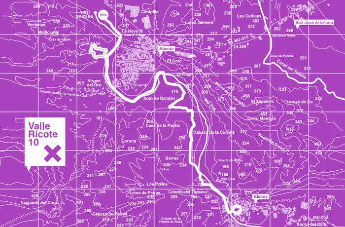 Valle de Ricote is basically a deep crack opened between mountains shaped by the waters of the Segura river over thousands of years. The area is now a fertile orchard with irrigated lands surrounded by steep hillsides.
Leaving Blanca, the route crosses over an iron bridge over the Segura River and continues on the B-17 road, which starts on the right river bank in Arenal, neighborhood of Los Runes, and runs all the way to the neighborhood Los Tollos. Here, in between the houses and before reaching kilometer 1, there is an abrupt right turn that goes down a path crossing over the Las Multas ravine (also known as Tejera). On the other side a trail runs between irrigation ditches and paddies in the Darrax area. At the end of the trail there is a dirt road surrounded by fruit trees in the Corona spot, right under the interesting Cabezo de la Cobertera high point.
Length: 8.5 km (10 miles)
Type: Lineal
Start: Plaza de la Farola (Blanca)
End: Noria Grande (Abarán)
Difficulty: Moderate
Time: 3 hours
0
comments

 Downloads
 Related links